Jump to content

Katrina


Baby Arm!

Recommended Posts

News this morning has Hurricane Katrina at Category 5 and tracking towards New Orleans. Expected landfall is sometime Monday morning.

Question is if there is extensive damage and flooding in SE Louisiana, what are the chances our game on Saturday would be postponed or even cancelled??

Any word from LSU on what their contingency plans are?

Edited by Baby Arm!
Link to comment
Share on other sites

  • Replies 70
  • Created
  • Last Reply

Top Posters In This Topic

Top Posters In This Topic

This what I have got so far. My dad works for the Shell plant in Norco which is right outside New Orleans. They have not begun to shut down the plant, which takes HOURS to do, because their weather people have said that it is gonna turn east before it makes landfall. Which puts it in Mississippi.

BUT even if it does hit New Orleans Baton Rouge should only get alittle wind and some rain. LSU draws its power from underground lines so even if Baton Rouge loses power LSU will be up and running.

I dont think the game will be played on another date because I have looked at the scheldules and neither team has an open date together, and since it is OOC it is not that big of a deal.

However to all you fans that may be flying into New Orleans or staying in New Orleans I would keep an eye on this thing and be ready to change your plans.

Link to comment
Share on other sites

They have evacuated ALL of New Orleans. They havn't begun to evacuate Mississippi yet, so I will follow the fleeing people as a sign of where the storm is headed. They have turned the Super Dome into a a refuge for people that can't get out of the city, so it looks like they think it can withstand the attack of a hurricane of this magnitude.

For anyone in the storms path my prayers are with you.

Link to comment
Share on other sites

The superdome and the area right around it is built to act as an ARK.

The problem is gonna be the surge. All of the above ground crypts will be destroyed there will be coffens floating everywhere, the sewers will back up. This would be horrible.

As far as the New Orleans bowl goes it would more then likely be moved to Tiger Stadium so that it can still be played.

Link to comment
Share on other sites

The superdome and the area right around it is built to act as an ARK.

Unfortunately, this could be a test of engineering theories. When the Superdome was constructed 30 years ago, it was designed to survive up to 175 MPH winds. This storm is currently sustaining winds at 175 MPH, and the wind speed has been gaining intensity.

Katrina almost looks like one of those doomsday models that weather experts have always said could happen.

Let's pray for the best but prepare for the worst. Our neighbors in Louisiana may need our help very soon.

********************************************************************

from weather.com:

Hurricane Katrina 4th Strongest Atlantic Hurricane

3:17 p.m. ET 8/28/2005

Hurricane Katrina is an extremely dangerous Category 5 storm on the Saffir-Simpson scale. Maximum sustained winds are at 175 mph. Katrina continues not only grow stronger, but it continues to grow larger. Hurricane-force winds extend 90 miles from the center on the eastern side of Katrina, 75 miles to the northwest and 50 miles to the southwest. Sustained tropical storm force winds are not far from the Gulf Coast and should move in later this afternoon. Katrina has turned and is moving northwest at 13 mph with a turn to the north expected tonight.

Everyone along the northern Gulf of Mexico should be completing preparations for a major hurricane and take heed of evacutation orders. Hurricane warnings are up from Morgan City, La., to the Florida-Alabama border. This includes the city of New Orleans and Lake Pontchartrain. A tropical storm warning and a hurricane watch have been issued from the Alabama-Florida border eastward to Destin, Florida and from west of Morgan City to Intracoastal City, Louisiana.

A storm surge of 20 to 25 feet or more is possible along and to the east of Katrina's landfall point Monday. On top of the water rise, pounding waves of 20 to 40 feet will produce catastrophic damage at coastal locations.

Effects from Katrina will not be confined to coastal areas. Once Hurricane Katrina makes landfall, it will progress inland Monday into Tuesday with a trail of flooding rains and damaging winds across Mississippi and Alabama and then into Tennessee. Torrential, flooding rainfall is possible with the remnants of Katrina well inland, possibly into the Ohio Valley, Great Lakes and the Northeast later this week.

Edited by ADLER
Link to comment
Share on other sites

Well, believe it are not, but down here on the upper Texas Coast that borders Louisiana, we are already receiving light breezes from Katrina. How do I know? When you've lived on the coast all your life, this type of wind is different. Ask MeanGreen61 for Corpus, he knows what I'm talking about. It gusts off and on. Still a beautiful, hot, sunny Sunday though.

Watching the weather channel I just hope that sumbitch doesn't head farther west. I might have to take you up on that couch offer. biggrin.gif

Edited by DeepGreen
Link to comment
Share on other sites

I have to agree with Emmitt...if this Hurricane hits New Orleans the way that they think it might, the least of our concern should be football games. As a city that the Mean Green has come to love over the last 3 years, we all need to be praying for the people of New Orleans and the surrounding cities. The restraunts we ate at, the people who served you a beer at the game. They are all fleeing for their lives right now and I just hope against hope that everything turns out as best it can. I don't normally follow these Hurricanes because they usually make these predictions and then it turns out to not be that bad but I have never seen them talk about one like this. Let's just hope that they are wrong..........

Link to comment
Share on other sites

You want chilling....this was sent to the city of NO this morning. If it hit at current intensity it would be the second strongest storm to hit the US in recorded history.

Urgent Weather Message for Orleans, LA

Top of pageTable of contents for Orleans, LA

WWUS74 KLIX 281550

NPWLIX

URGENT - WEATHER MESSAGE

NATIONAL WEATHER SERVICE NEW ORLEANS LA

1011 AM CDT SUN AUG 28 2005

DEVASTATING DAMAGE EXPECTED

HURRICANE KATRINA

A MOST POWERFUL HURRICANE WITH UNPRECEDENTED

STRENGTH...RIVALING THE INTENSITY OF HURRICANE CAMILLE OF 1969.

MOST OF THE AREA WILL BE UNINHABITABLE FOR WEEKS...PERHAPS LONGER. AT

LEAST ONE HALF OF WELL CONSTRUCTED HOMES WILL HAVE ROOF AND WALL

FAILURE. ALL GABLED ROOFS WILL FAIL...LEAVING THOSE HOMES SEVERELY

DAMAGED OR DESTROYED.

THE MAJORITY OF INDUSTRIAL BUILDINGS WILL BECOME NON FUNCTIONAL.

PARTIAL TO COMPLETE WALL AND ROOF FAILURE IS EXPECTED. ALL WOOD

FRAMED LOW RISING APARTMENT BUILDINGS WILL BE DESTROYED. CONCRETE

BLOCK LOW RISE APARTMENTS WILL SUSTAIN MAJOR DAMAGE...INCLUDING SOME

WALL AND ROOF FAILURE.

HIGH RISE OFFICE AND APARTMENT BUILDINGS WILL SWAY DANGEROUSLY...A

FEW TO THE POINT OF TOTAL COLLAPSE. ALL WINDOWS WILL BLOW OUT.

AIRBORNE DEBRIS WILL BE WIDESPREAD...AND MAY INCLUDE HEAVY ITEMS SUCH

AS HOUSEHOLD APPLIANCES AND EVEN LIGHT VEHICLES. SPORT UTILITY

VEHICLES AND LIGHT TRUCKS WILL BE MOVED. THE BLOWN DEBRIS WILL CREATE

ADDITIONAL DESTRUCTION. PERSONS...PETS...AND LIVESTOCK EXPOSED TO THE

WINDS WILL FACE CERTAIN DEATH IF STRUCK.

POWER OUTAGES WILL LAST FOR WEEKS...AS MOST POWER POLES WILL BE DOWN

AND TRANSFORMERS DESTROYED. WATER SHORTAGES WILL MAKE HUMAN SUFFERING

INCREDIBLE BY MODERN STANDARDS.

THE VAST MAJORITY OF NATIVE TREES WILL BE SNAPPED OR UPROOTED. ONLY

THE HEARTIEST WILL REMAIN STANDING...BUT BE TOTALLY DEFOLIATED. FEW

CROPS WILL REMAIN. LIVESTOCK LEFT EXPOSED TO THE WINDS WILL BE

KILLED.

AN INLAND HURRICANE WIND WARNING IS ISSUED WHEN SUSTAINED WINDS NEAR

HURRICANE FORCE...OR FREQUENT GUSTS AT OR ABOVE HURRICANE FORCE...ARE

CERTAIN WITHIN THE NEXT 12 TO 24 HOURS.

ONCE TROPICAL STORM AND HURRICANE FORCE WINDS ONSET...DO NOT VENTURE

OUTSIDE!

LAZ038-040-050-056>070-282100-

ASSUMPTION-LIVINGSTON-LOWER JEFFERSON-LOWER LAFOURCHE-

LOWER PLAQUEMINES-LOWER ST. BERNARD-LOWER TERREBONNE-ORLEANS-

ST. CHARLES-ST. JAMES-ST. JOHN THE BAPTIST-ST. TAMMANY-TANGIPAHOA-

UPPER JEFFERSON-UPPER LAFOURCHE-UPPER PLAQUEMINES-UPPER ST. BERNARD-

UPPER TERREBONNE-

1011 AM CDT SUN AUG 28 2005

INLAND HURRICANE WIND WARNING IN EFFECT

HURRICANE KATRINA

A MOST POWERFUL HURRICANE WITH UNPRECEDENTED

STRENGTH...RIVALING THE INTENSITY OF HURRICANE CAMILLE OF 1969.

ONSET OF TROPICAL STORM FORCE WINDS WILL BE AROUND 3 PM THIS

AFTERNOON AND PERSIST FOR ABOUT 26 HOURS. HURRICANE FORCE WINDS WILL

ONSET AROUND SUNSET TONIGHT IN LOWER PLAQUEMINES PARISH AND SPREAD

NORTHWARD BY 3 AM MONDAY MORNING...PERSISTING FOR ABOUT 12 TO 17

HOURS. MAXIMUM SUSTAINED WINDS IN EXCESS OF 140 MPH CAN LAST FOR 2

TO 3 HOURS.

ONCE TROPICAL STORM AND HURRICANE FORCE WINDS ONSET...DO NOT VENTURE

OUTSIDE!

Link to comment
Share on other sites

I left bnew orleans for baton rouge and we should be okay. okay being nothing more than 70ph sustained winds with gusts near 100. Baton rouge should bne okay and I think the game will be fine, BUT, I suggest anyone who was planning on staying in new oprleans to call and find substitute hotels in the baton rouge area. if this thing leeps on its track New Orleans probably will not be able to handle your resveration. I even brought my tickets with me for our game b/.c I do not expect a house to go home to, or the time between now and then to go get them.

I probably will not be able to post much but as the conditions worsen in baton Rouge, I will try to keep you notified.

PLEASE, WHOEVER IT IS YOU PRAY TO, SAY A PRAYER FOR THOSE OF US IN AND NEAR NEW ORLEANS. MYSELF AND THE MILLION + PEOPLE IN THE AREA NEED ALL THE HELP WE CAN GET.

Link to comment
Share on other sites

I have to agree with Emmitt...if this Hurricane hits New Orleans the way that they think it might, the least of our concern should be football games.  As a city that the Mean Green has come to love over the last 3 years, we all need to be praying for the people of New Orleans and the surrounding cities.  The restraunts we ate at, the people who served you a beer at the game.  They are all fleeing for their lives right now and I just hope against hope that everything turns out as best it can.  I don't normally follow these Hurricanes because they usually make these predictions and then it turns out to not be that bad but I have never seen them talk about one like this.  Let's just hope that they are wrong..........

Agree, Emmitt & UNTSIG, those people are in some kind of deep danger and are in need of some hard prayin' folks across this great country of ours. Forget the LSU football game--it's #101 on a priortiy list of 100 far more important things to do with human lives at the top of the list.

As Deep Green/MG61/Island Eagle would I'm sure concur, those of us who grew up or have lived on the Gulf Coast know that feeling of anxiety and uncertainty from these mega-storms. I was 10 when a pretty hard hittin' Hurricane Carla came thru the Houston/Galveston/Freeport area. My dad helped close down Dow Chemical Co (Freeport) where he worked for 37 years, he then boarded up our house and immediaely left town taking our family to Mexia/Groesbeck to stay with some relatives for a few days.

You folks in in New Orleans and well beyond the Big Easy, please use your good judgement, but as I watch CNN showing live shots of people file into the SuperDome (whose own safety as a refugee facility concerns me); anyway, IMO having gone thur far less dangerous hurricanes than Katrinia, please board up the houses if you still have time and get the heck out of Dodge.

Edited by PlummMeanGreen
Link to comment
Share on other sites

Agree, Emmitt & UNTSIG, those people are in some kind of deep danger and are in need of some hard prayin' folks across this great country of ours.  Forget the LSU football game--it's #101 on a priortiy list of 100 far more important things to do with human lives at the top of the list.

As Deep Green/MG61/Island Eagle would I'm sure concur, those of us who grew up or have lived on the Gulf Coast know that feeling of anxiety and uncertainty from these mega-storms.  I was 10 when a pretty hard hittin' Hurricane Carla came thru the Houston/Galveston/Freeport area.  My dad helped close down Dow Chemical Co (Freeport) where he worked for 37 years, he then boarded up our house and immediaely left town taking our family to Mexia/Groesbeck to stay with some relatives for a few days.

You folks in in New Orleans and well beyond the Big Easy, please use your good judgement, but as I watch CNN showing live shots of people file into the SuperDome (whose own safety as a refugee facility concerns me); anyway, IMO having gone thur far less dangerous hurricanes than Katrinia, please board up the houses if you still have time and get the heck out of Dodge.

Amen to all that. My heart goes out to the folks in southeast Louisiana. It could have just as easily been Galveston, Port Arthur, or Houston. Hopefully, all will get out of harm's way. This is no storm to trifle with.

Link to comment
Share on other sites

Sherpard Smith of FoxNews is just standing in the french quarter reporting. He says the whole thing could be gone tomorrow morning. Hopefully he'll be ok.....

This is such a terrible thing and is even more impactful since after being there for the bowl games, you know exactly where everything is they are talking about. I can't imaging camping out in the superdome. I hope to God it withstands the winds for all those who are using it as a last resort shelter.

My prayers are with everyone there.

Link to comment
Share on other sites

Just talked to a friend whose in-laws from Baton Rouge are here in Texas. Three brother in laws are still in Baton Rouge waiting to see if they are going to have to board up theirs and their parents houses and head to Texas.

The weather forecasters in LA are saying Baton Rouge is probably going to get the rain and the hurricane force winds.

Someone said earlier and I will say it again, we need to keep the people of LA, AL and MS in our thoughts and prayers. The next couple of days are going to be a living hell for them.

Link to comment
Share on other sites

Join the conversation

You can post now and register later. If you have an account, sign in now to post with your account.
Note: Your post will require moderator approval before it will be visible.

Guest
Reply to this topic...

×   Pasted as rich text.   Paste as plain text instead

  Only 75 emoji are allowed.

×   Your link has been automatically embedded.   Display as a link instead

×   Your previous content has been restored.   Clear editor

×   You cannot paste images directly. Upload or insert images from URL.


  • Tell a friend

    Love GoMeanGreen.com? Tell a friend!
  • What's going on Mean Green?

    1. 0

      How Mean Green softball is shaping up in 2025 and beyond

    2. 23

      Former Drake Guard Atin Wright commits to North Texas

    3. 23

      Former Drake Guard Atin Wright commits to North Texas

    4. 23

      Former Drake Guard Atin Wright commits to North Texas

    5. 7

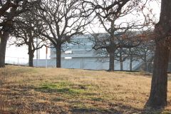
      The last home games of the 2023-24 school year

  • Popular Contributors

  • Member Statistics

    • Total Members
      15,379
    • Most Online
      1,865

    Newest Member
    KeithSHU
    Joined
×
×
  • Create New...

Important Information

We have placed cookies on your device to help make this website better. You can adjust your cookie settings, otherwise we'll assume you're okay to continue. Please review our full Privacy Policy before using our site.