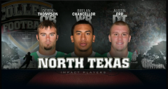
Jump to content

Recommended Posts

Okay people, crowdsourcing opinions (I know, very brave of me).

We (Denton County GIS) unveiled an app today as part of a project in cooperation with the health department to increase transparency and provide better decision-making tools.

Here's an app (mobile friendly) that shows mosquito testing areas, and results. The basic goal is to inform people that, hey, my family and I should wear repellent today.

Come at me with critiques, suggestions, what you hate. We want to try to make it as easy as possible for folks in the public to read. Any suggestions are helpful.

http://www.dentoncounty.com/vmap 

  • Upvote 2
Link to comment
Share on other sites

1 hour ago, Army of Dad said:

The disclaimer has 'presence' mispelled.

I didn't see a key, but assume the grey mosquito icons are traps that haven't reported?

Whoops on the typo and the coloration was a recent concept, can include a legend.

1 hour ago, Army of Dad said:

Are all of the icons accurately placed on the map?

Will you link to any health department pages with info?

The icons are not accurate on purpose. They are placed in the area to represent the area, not the trap location. Don't want crazies out there messing with our stuff.

This web map is the end point from the health website, but it'd be a good idea to include a link back to the health website in the disclaimer.

Thanks for taking the time!

  • Upvote 1
Link to comment
Share on other sites

23 minutes ago, Aldo said:

Whoops on the typo and the coloration was a recent concept, can include a legend.

The icons are not accurate on purpose. They are placed in the area to represent the area, not the trap location. Don't want crazies out there messing with our stuff.

This web map is the end point from the health website, but it'd be a good idea to include a link back to the health website in the disclaimer.

Thanks for taking the time!

Ok, was hoping icons were accurate to zip code for multiple locations (only one icon in city of Denton).

Happy to help.

Link to comment
Share on other sites

Just now, Army of Dad said:

Ok, was hoping icons were accurate to zip code for multiple locations (only one icon in city of Denton).

Happy to help.

Ah yes that one and Corinth are weird. We didn't get enough location-specific data from them. Corinth contains maybe like 5 sites, and Denton has double digits, but I didn't have enough info to go off of to find the right place. Had to just aggregate them. Hoping that improves in the next iteration.

It's been an interesting process getting different datasets from different municipalities, to say the least. Everyone does things differently.

  • Upvote 1
Link to comment
Share on other sites

  • 2 weeks later...
2 minutes ago, Army of Dad said:

Nice, I like the more specific location data.

How often is it updated?

It's somewhat accurate because Carrollton has had several traps report positive just recently. We have spraying taking place the next few nights.

  • Upvote 1
Link to comment
Share on other sites

35 minutes ago, Army of Dad said:

Nice, I like the more specific location data.

How often is it updated?

For mosquito count, I get new data about every two weeks.

As far as positive trap locations, as @UNTFan23 pointed out, it's as soon as I know.

Either an agency like Highland Village will contact me, or if I see it in the news I'll contact the agency. Carrollton is managed by Dallas County so I had to reach out to them when I saw the report in a tweet.

  • Upvote 1
Link to comment
Share on other sites

It is my understanding that mosquitos don't travel far.  Like less than a mile.  So is this project more about alerting citizens to concentration levels or the presence of infected mosquitos (i.e west nile and zika).  It seems that it would provide little benefit for the former and much benefit for the latter.  Love the project and the ease of use just curiosity on my part. 

Link to comment
Share on other sites

Exactly @HoustonEagle. Some species travel 1/4 mile (WNV carrying) or around 200 meters (ChikV or Zika carrying). So these are placed in highly populated areas. 

The presence of infected mosquitos is more important for the public, while the concentration is more for public health officials.

Edited by Aldo
Link to comment
Share on other sites

  • 2 weeks later...
  • 3 weeks later...
35 minutes ago, Army of Dad said:

Thanks for building this and keeping us updated.

If a trap site has a WNV positive does that site stay 'red' all season?

For precautionary reasons, yes. Even if they stop showing up positive.

Just because we may not find another positive mosquito doesn't mean that the birds aren't still carrying it in that area (enzootic transmission). And since we aren't trapping in every single corner of the county (or testing birds) we don't know.

Edited by Aldo
  • Upvote 1
Link to comment
Share on other sites

On August 2, 2016 at 5:08 PM, Aldo said:

For precautionary reasons, yes. Even if they stop showing up positive.

Just because we may not find another positive mosquito doesn't mean that the birds aren't still carrying it in that area (enzootic transmission). And since we aren't trapping in every single corner of the county (or testing birds) we don't know.

The site looks like it's down. Sucks because I was trying to show it to a coworker 

Link to comment
Share on other sites

5 minutes ago, Army of Dad said:

The site looks like it's down. Sucks because I was trying to show it to a coworker 

thanks looking into it.

Hm, seems to be an IT thing. @Army of Dad, my original link (hence the shortening of it) is working: http://dentoncounty.maps.arcgis.com/apps/webappviewer/index.html?id=6a72a6ab94214cb0901bac3ea94a7674 

Or the bitly version. http://arcg.is/1r5PWqu

Put in a request, hopefully back up soon.

11 minutes ago, Harry said:

Is there anything like this for Dallas?  My dad would love something like this but he lives in Farmers Branch.

Best I can find so far: http://www.dallascounty.org/department/hhs/documents/DCHHSEpiWNVWeeklyReport_8_8_2016.pdf

  • Upvote 1
Link to comment
Share on other sites

33 minutes ago, Aldo said:

thanks looking into it.

Hm, seems to be an IT thing. @Army of Dad, my original link (hence the shortening of it) is working: http://dentoncounty.maps.arcgis.com/apps/webappviewer/index.html?id=6a72a6ab94214cb0901bac3ea94a7674 

Or the bitly version. http://arcg.is/1r5PWqu

Put in a request, hopefully back up soon.

Best I can find so far: http://www.dallascounty.org/department/hhs/documents/DCHHSEpiWNVWeeklyReport_8_8_2016.pdf

Thanks.

  • Upvote 1
Link to comment
Share on other sites

  • 2 weeks later...
  • 4 weeks later...

Join the conversation

You are posting as a guest. If you have an account, sign in now to post with your account.
Note: Your post will require moderator approval before it will be visible.

Guest
Reply to this topic...

×   Pasted as rich text.   Paste as plain text instead

  Only 75 emoji are allowed.

×   Your link has been automatically embedded.   Display as a link instead

×   Your previous content has been restored.   Clear editor

×   You cannot paste images directly. Upload or insert images from URL.


×
×
  • Create New...

Important Information

We have placed cookies on your device to help make this website better. You can adjust your cookie settings, otherwise we'll assume you're okay to continue. Please review our full Privacy Policy before using our site.